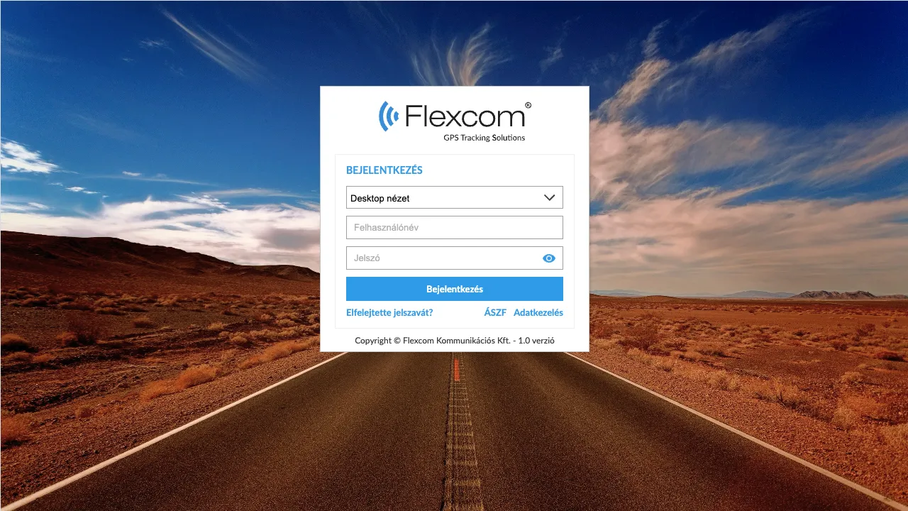
To use the system, a valid user registration and subsequent login are required. Upon login, the system verifies the provided data; if the data is correct, the user gains access to the system's services. In case of a forgotten password, it is possible to request a temporary password. Registered data can be modified at any time later through the system's Profile function.

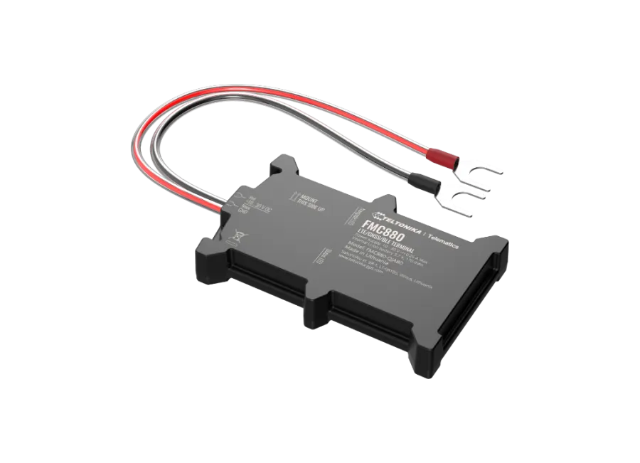
Teltonika FMC880-E 4G LTE vehicle GPS tracker – Protection for engine bay installation
Brand: TELTONIKA
Product code: FMC880E
EAN: 4779027310534
Professional 4G LTE vehicle GPS tracker designed specifically for installation in the engine compartment. It can be connected directly to the vehicle battery, making installation quick and simple. The device updates position data with 3-meter accuracy, ensuring continuous and reliable monitoring of vehicles. More information
75
€
(75
€ + 0% VAT)
-
In stock66 pcs
-
Local pickupFree
-
Expected delivery-
-
Guarantee24 months
-
Home delivery-
-
Location of goodsHungary
Device description
Teltonika FMC880-E 4G LTE vehicle GPS tracker – Protection for engine bay installation
The TELTONIKA FMC880-E 4G LTE combines all the functions of precise positioning and vehicle monitoring in a durable device designed for the engine compartment. The manufacturer specifically designed it for operation in closed engine bays, allowing for easy and protected installation by connecting it directly to the battery terminals. It supports modern internet data transmission technologies and communication with professional data collection systems.
The device's operation is based on the stable 4G network and precise satellite positioning. Position data and alerts are accessible at any time via SMS or online tracking software, allowing the vehicle's movement to be monitored in real-time. Built-in intelligent features and Bluetooth connectivity enable the use of external sensors, further increasing the security level.
Features and Specifications
- Cooperation with multiple satellite systems (GPS, GLONASS, GALILEO, BEIDOU).
- Communication with the monitoring system via Bluetooth or GSM 2G and 4G networks.
- Connection of external devices via Bluetooth (e.g., temperature sensor, driver ID, mobile phone).
- Operating settings and position querying via SMS or software.
- Configurable position measurement time intervals and SMS alert settings.
- Power-on upon connection to power from its own or an external battery.
- Moisture and splash-resistant design for engine compartment conditions.
- Built-in accelerometer, gyroscope, and internal backup battery (approx. 30 minutes bridging time).
- Internal high-sensitivity GNSS antenna and LED status indicators.
- Automatic switching between sleep and wake modes for energy efficiency.
- Continuous operation when connected to the vehicle's power source.
Alerts
- Movement detection from a stationary position.
- Towing detection in case of unauthorized movement.
- Ignition status change.
- Alert for device removal or power disconnection.
- Leaving a POI digital fence (Geofence) or arriving at a specific zone.
Package Contents
- TELTONIKA FMC880-E 4G LTE vehicle GPS tracker.
- Connection cable.
- Quick Start Guide.
Terms of Use
For normal operation, an active connection to satellite positioning systems and mobile operator networks is required. These ensure data collection and transmission to the owner's phone or to a central system. The device communicates over the mobile operators' network using a replaceable micro SIM card placed inside.
Operating Region
- 4G: Europe, Middle East, Asia, Asia-Pacific.
- 2G: World.
Purchase Options
- If you purchase the device only (no software subscription), we provide it with factory settings. You are responsible for the SIM card required for operation, its settings, and its management (top-ups, annual data reconciliation).
- If you purchase a software subscription alongside the device but not a SIM card, we provide the device already registered in our software and ready for use. However, obtaining, setting up, and operating the SIM card remains your responsibility.
- If you purchase the SIM card from us along with the device and software subscription, we provide the device and SIM card ready to work with the software, and we take care of the continuous operation of the card – you will have no tasks regarding the latter.
In case of a software subscription, if you wish to use our software's SMS alert service in addition to email notifications, please also purchase an SMS credit card, which you can find in our webshop among the products related to the device.
The device descriptions and images on the website are based on information published by the manufacturer, which are not always accurate or error-free. The manufacturer reserves the right to modify certain parameters or packaging of the product without prior notice - the update of the data related to these on our website takes place after the detection and evaluation of the changes.
View full description CloseSpecifications
| Communication | |
|---|---|
| 2G GPRS | yes |
| 2G Operating Region: Africa | yes |
| 2G Operating Region: Asia | yes |
| 2G Operating Region: Asia Pacific | yes |
| 2G Operating Region: Australia | yes |
| 2G Operating Region: Europe | yes |
| 2G Operating Region: Middle East | yes |
| 2G Operating Region: North America | yes |
| 2G Operating Region: South America | yes |
| 2G Operating Region: World | yes |
| 4G lte | yes |
| 4G network | yes |
| 4G Operating region: Asia | yes |
| 4G Operating Region: Asia Pacific | yes |
| 4G Operating region: Europe | yes |
| 4G Operating region: Middle East | yes |
| Accuracy | 2.5 meter |
| AGPS | yes |
| BEIDOU | yes |
| Bluetooth | yes |
| Bluetooth version | 4 |
| DGPS | yes |
| FDD 4G Band 1 | yes |
| FDD 4G Band 20 | yes |
| FDD 4G Band 28 | yes |
| FDD 4G Band 3 | yes |
| FDD 4G Band 5 | yes |
| FDD 4G Band 7 | yes |
| FDD 4G Band 8 | yes |
| GALILEO | yes |
| GLONASS | yes |
| GNSS channel number | 75 |
| GPS | yes |
| GPS module name | AIROHA AG3335 |
| GSM 1800 | yes |
| GSM 1900 | yes |
| GSM 850 | yes |
| GSM 900 | yes |
| GSM module | QUECTEL EG915U-EU |
| SBAS | yes |
| Sensitivity | -165 dBm |
| SIM card micro | yes |
| SMS | yes |
| Built-in function | |
| Acceleration measurement | yes |
| Crash detection | yes |
| Excessive Idling detection | yes |
| Green Driving | yes |
| GSM signal strength measurement | yes |
| Ignition detection from accelerometer | yes |
| Ignition detection from digital input | yes |
| Ignition detection from external power voltage | yes |
| Jamming detection | yes |
| Measuring the number of GPS satellites | yes |
| Over Speeding detection | yes |
| Towing detection | yes |
| Unplug detection | yes |
| Sensor | |
| Accelerometer | yes |
| Removal detection sensor | yes |
| Speed sensor | yes |
| Interface | |
| Analog input number(s) | 1 |
| Number of CAN connectors | 0 |
| Cellular antenna input number(s) | 0 |
| Digital input number(s) | 1 |
| Digital output number(s) | 1 |
| Driver ID input | yes |
| GNSS antenna input number(s) | 0 |
| GPS LED | yes |
| GSM LED | yes |
| Impulse input number(s) | 0 |
| Internal GNSS antenna | yes |
| Internal GPS antenna | yes |
| Internal GSM antenna | yes |
| Negative input number(s) | 0 |
| Temperature sensor input | yes |
| USB micro | yes |
| Wire data input number(s) | 0 |
| Operation | |
| Auto geofence | yes |
| Battery charge temperature maximum | 45 Celsius |
| Battery charge temperature minimum | 0 Celsius |
| Battery discharge temperature maximum | 60 Celsius |
| Battery discharge temperature minimum | -20 Celsius |
| Battery operating time | 7 hour |
| Battery standby time | 45 hour |
| Battery storage temperature maximum | 45 Celsius |
| Battery storage temperature minimum | -20 Celsius |
| Cold start | 35 second |
| Data upload frequency is maximum | 43200 second |
| Deep Sleep | yes |
| GPS | Yes |
| GPS Sleep | yes |
| GPS | yes |
| Hot Start | 1 second |
| Manual geofencing | yes |
| Minimum data upload frequency | 5 second |
| NITZ | yes |
| NTP | yes |
| Online Deep Sleep | yes |
| Operating humidity maximum | 95 % |
| Operating humidity minimum | 5 % |
| Operating temperature without battery maximum | 85 Celsius |
| Operating temperature without battery minimum | -40 Celsius |
| Ultra Deep Sleep | yes |
| Warm start | 25 second |
| Energy | |
| Backup battery capacity | 170 mAh |
| Backup battery voltage | 3.7 V |
| External power source | yes |
| Input (DC) voltage maximum | 30 V |
| Input (DC) voltage minimum | 10 V |
| Internal battery | yes |
| Power consumption Deep Sleep | 3.21 mA |
| Power consumption GPS Sleep | 5.48 mA |
| Power consumption Nominal | 24.41 mA |
| Power consumption Online Sleep | 3.75 mA |
| Power consumption Ultra Deep Sleep | 1.47 mA |
| Certificate | |
| CE/RED | yes |
| E-Mark | yes |
| REACH | yes |
| RoHS | yes |
| Design | |
| Color | black |
| Height | 14 millimeter |
| Ingress Protection Rating | 65 |
| Length | 92.5 millimeter |
| Material | plastic |
| Weight | 80 gram |
| Width | 57.6 millimeter |
| Alarm | |
| Geofence entry alarm | yes |
| Geofence exit alarm | yes |
| Displacement alarm | yes |
| Low battery alarm | yes |
| Removal alert | yes |
| Towing alarm | yes |
| Setting option | |
| FMBT mobile software bluetooth | yes |
| FOTA | yes |
| FOTA Web | yes |
| Teltonika Configurator | yes |
| Via Internet | yes |
| Via SMS | yes |
| Via USB | yes |
| Data storage | |
| Internal memory | 128 Megabyte |
| Accessory | |
| Power cable with connector | yes |
Tracking Software Application
Flexcom tracking software provides professional services that allow you to determine at any moment where your monitored assets (vehicles, machinery, shipments, or valuable equipment) are located, where they are headed, and what routes they have taken. All of this can be tracked on an interactive map, and related status reports can be displayed and queried in text format – even retroactively, for any specified period. In addition to basic functions, POI points can be added and alerts can be configured.
The software works with various types of tracking devices, from permanently installed on-board units to mobile, installation-free portable models. No special expertise or unique computer software is required to operate the devices and use the map service – any standard computer, tablet, or smartphone with an internet connection is sufficient.
Key Features
Do you want to achieve truly high-level GPS tracking?
-
Map Visualization

Track your devices on different types of zoomable maps, and check their status and surroundings.
-
Real-Time Tracking
Continuously monitor the movement of your fleet and receive real-time information on their current position.
-
Route History
Review the routes previously traveled by vehicles: road sections, stopping points, and related data. You can also generate graphical analyses for these.
-
Device Information
Up-to-date information on device status and vehicle operating parameters (e.g., ignition, speed).
-
Alerts
Receive instant notifications via email or SMS about device or vehicle-related events – such as movement, POI zone crossing, towing, ignition, low battery, SOS signals, etc.
-
POIs
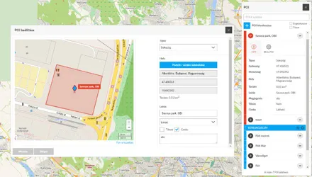
Add points and areas important to you to the map. You can set alerts for these or display the data in reports (e.g., journey logs) within the system.
Demo Videos
- User Management
System Access
- Using the Map
Map Types and Functions
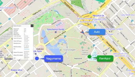
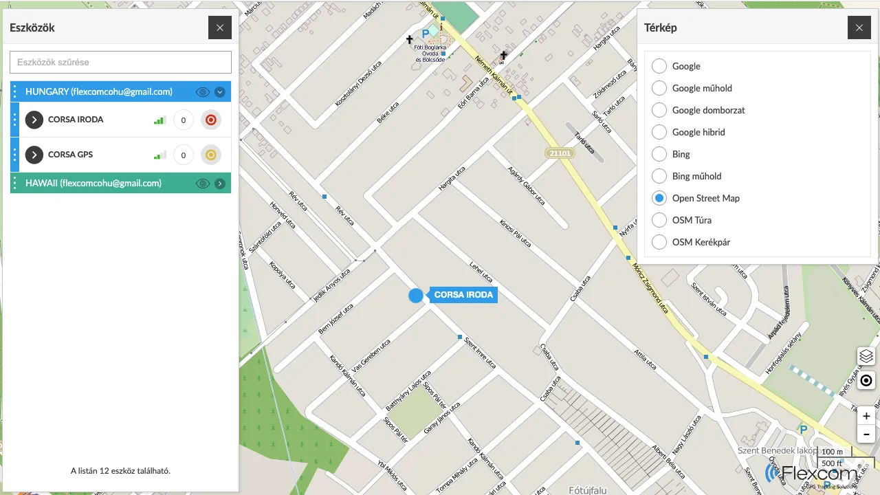
The map is a fundamental element, the "background interface" of the system. During tracking, several types of maps can be used, such as versions specialized for road networks, pedestrian, or bicycle routes in the case of Open Street Map.
- Device Management and Tracking
Retrieving Device Information
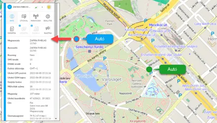
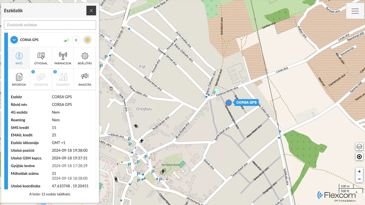
After a successful login, the system displays our devices on the map. In addition to the real-time display of their current movement, you can obtain detailed information by selecting any device:
- On the device's position (coordinates and address)
- On device and network characteristics (e.g., battery level, GSM and satellite connections)
- On the physical status (e.g., fuel, battery, operating hours) of the vehicle or equipment equipped with the tracker.
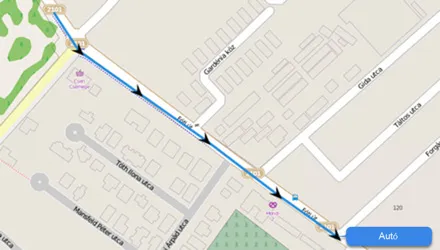
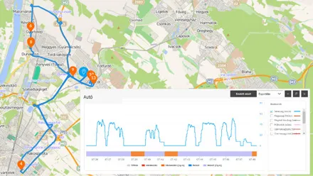
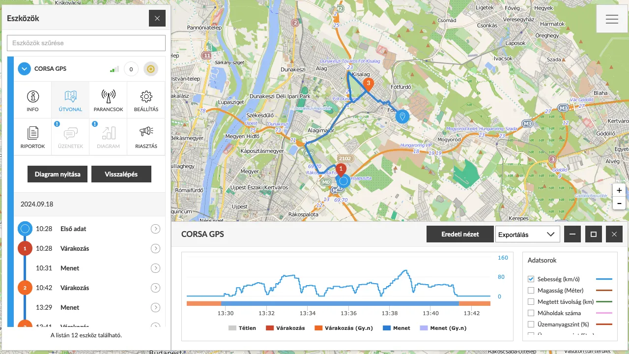
Route DisplayIn the tracking system, you can see not only current events, but previous events related to devices and vehicles can also be retrieved. Routes for a specific period can be requested. The system displays the route and related event points on the map, providing detailed information: the time taken for each section, the speed of travel, the distance covered, and where and for how long the asset waited.
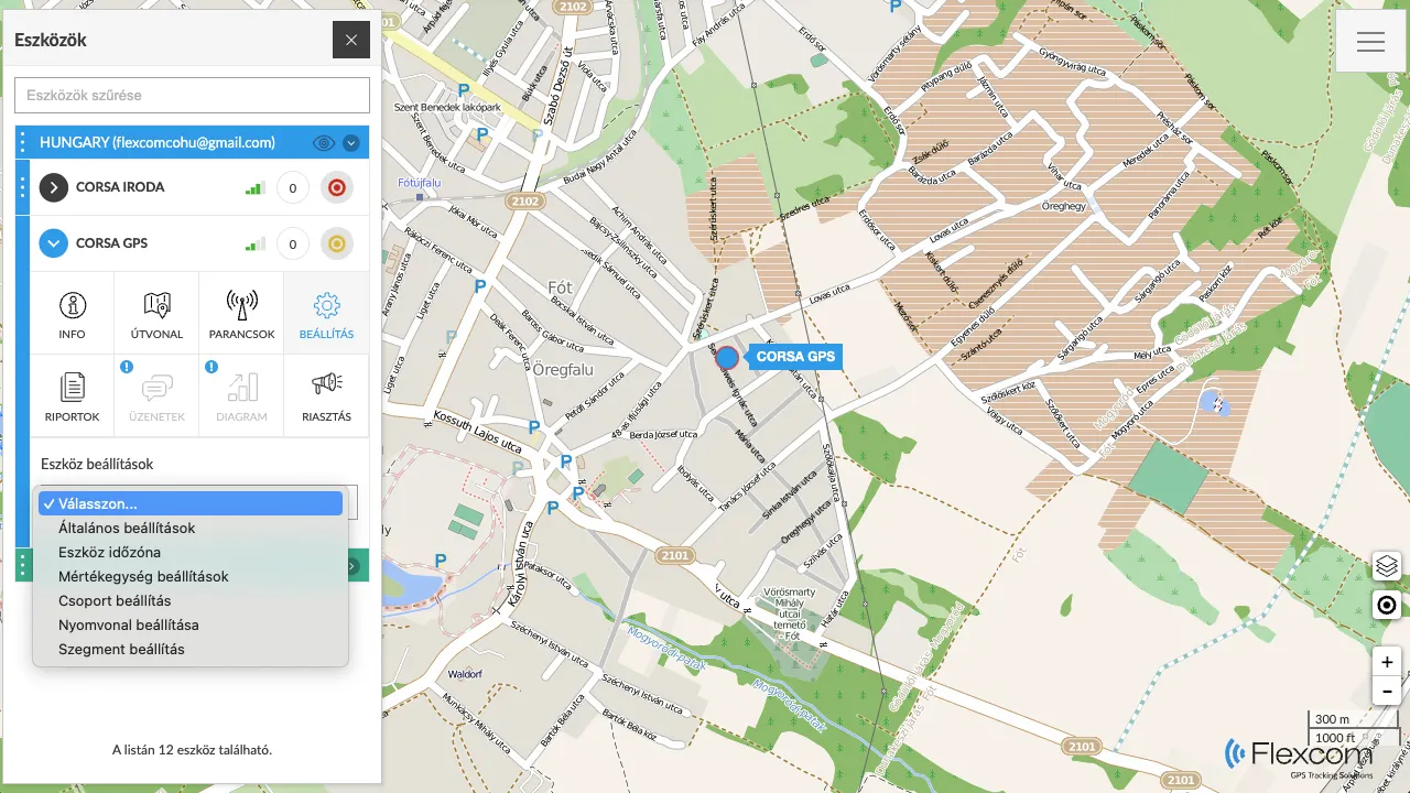
Device SettingsYou can configure how the central system handles your devices and incoming data. Devices can be grouped, labeled, or marked with colors on the map. The system can be configured with measurement units (e.g., kilometers or miles), motion detection modes, and time zone specifications.
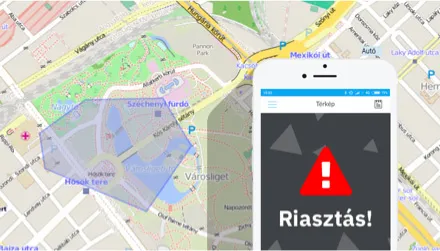
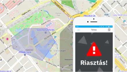
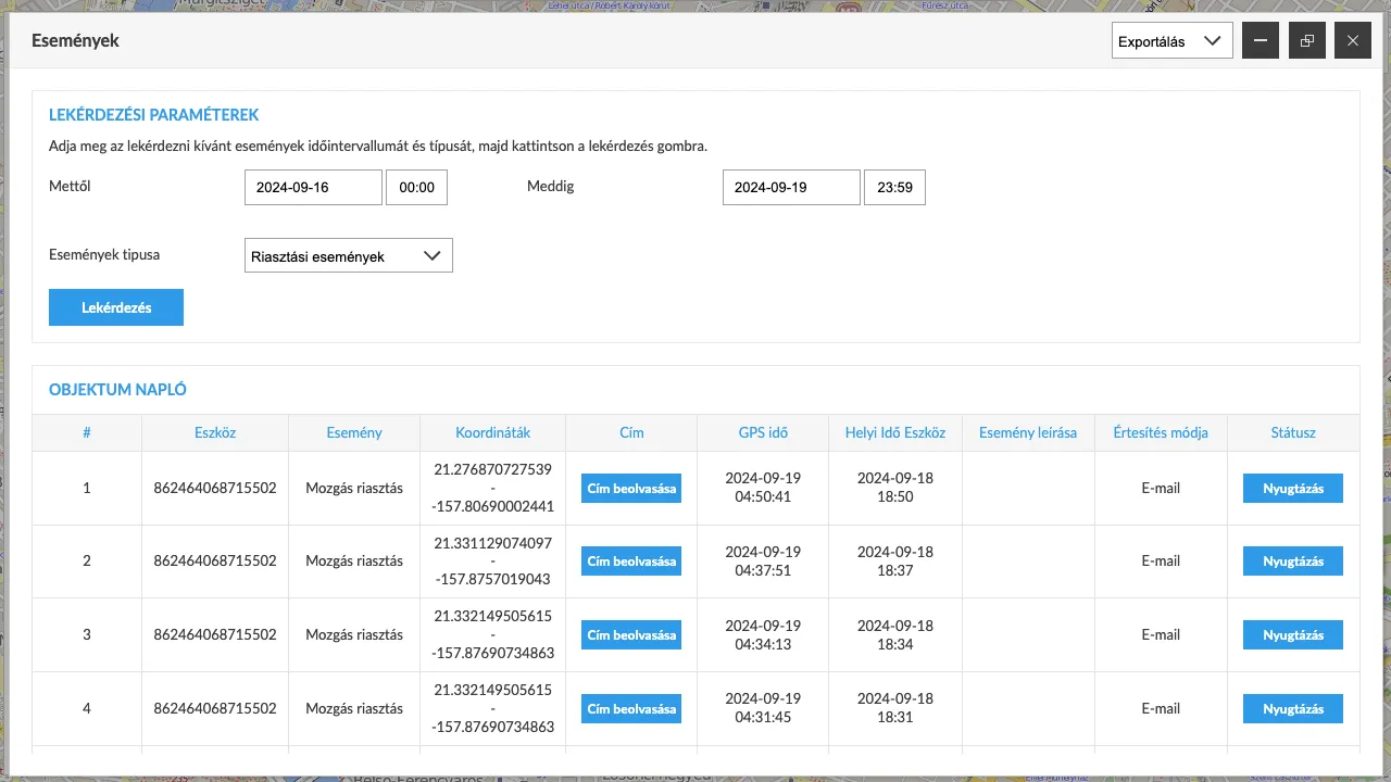
AlertsThe system can send notifications (alerts) about events related to vehicles or devices, such as displacement (movement), towing, or leaving specific zones. Alerts can be set up individually for each device. For certain devices, SOS calls and messages are a special feature, operating by calling pre-set phone numbers and sending emails and/or SMS notifications.
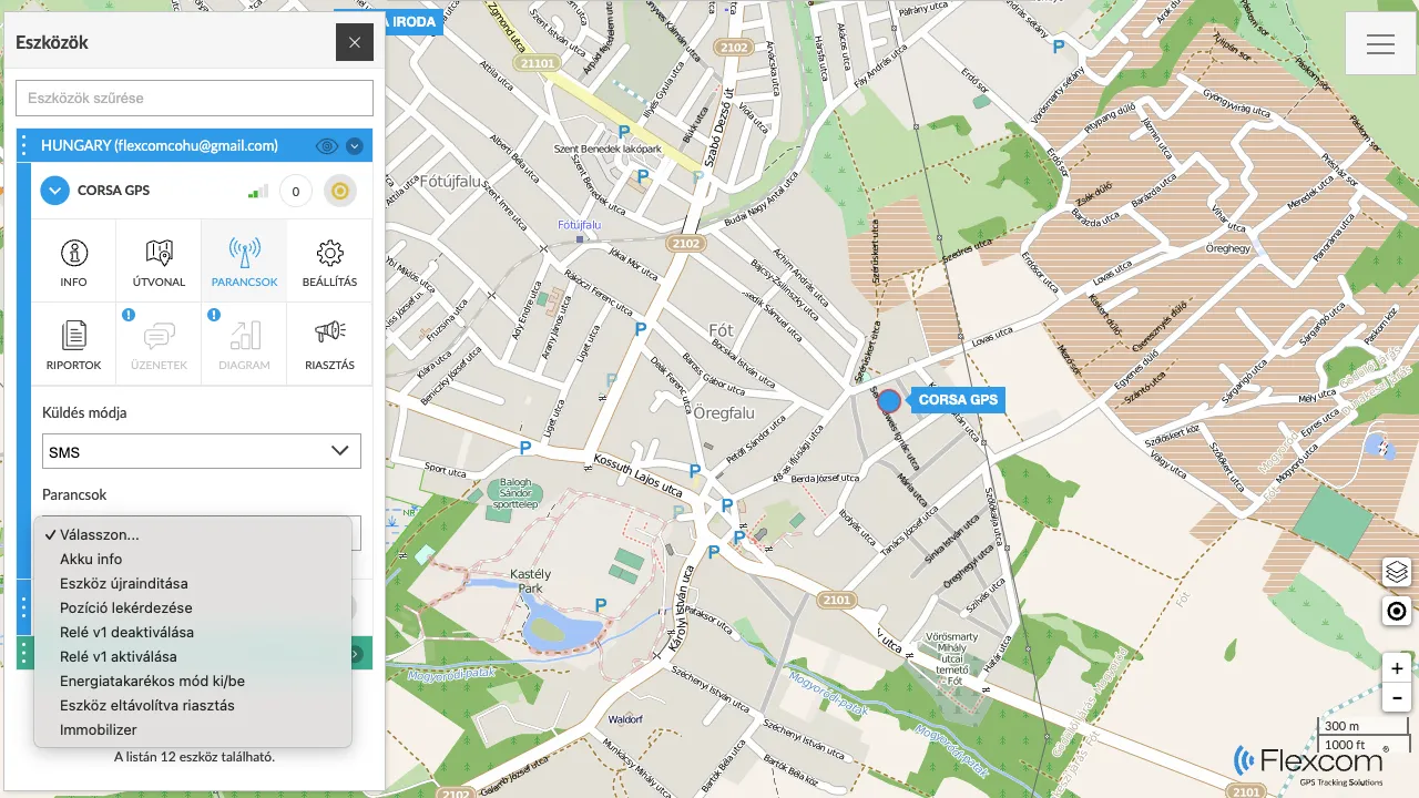
CommandsThe complete system consists of tracking devices and tracking software. As technical equipment, the devices have their own operating settings, such as position reporting frequency, contact numbers, alarm or time zone settings, sounding a signal for searching, remote shutdown, etc. These settings and actions can be performed through the software's Send Command function.
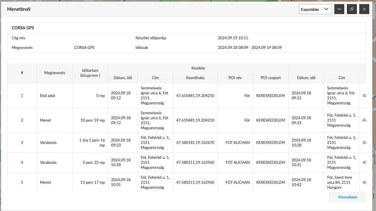
ReportsIn addition to graphical map data and directly related text data, complex reports can be generated using the Reports function. A frequently used report, for example when tracking vehicles, is the journey log (logbook).
- Managing POIs
Adding POIs
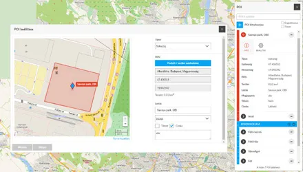
POIs (Points of Interest) are significant locations that you want to mark on the map. A POI can be a point (e.g., a gas station or shop) or an area (e.g., a plot of land). Accordingly, point-based and area-based POIs can be added to the tracking system, and the shapes of the latter can be drawn manually. Alerts can also be assigned to POIs for when a tracking device arrives at or leaves them.
- Event Management
Events and Recording. Using the Event Log.
Events occur continuously within the tracking system. Devices detect movement, stops, and physical impacts. The processing system analyzes the incoming data and determines the related events, which are recorded in the event log. The log is available for customers to view and can be filtered or queried based on various criteria.
Similar products

Related products

Customer reviews
Product reviews
| 5 Stars | (0) | |
| 4 Stars | (0) | |
| 3 Stars | (0) | |
| 2 Stars | (0) | |
| 1 Stars | (0) |
Last viewed products

Frequently Asked Questions
What rules apply to the tracking of company or employee vehicles?
When tracking company or employee vehicles, we always recommend informing the affected employee and obtaining their written consent. This is important not only for GDPR compliance but also for maintaining workplace trust.
How much experience does FlexCom have in the GPS technology field?
FlexCom Kommunikációs Kft. has over 10 years of professional experience in the sale and repair of GPS devices and the development of proprietary GPS software. Our expertise guarantees that our customers receive the most reliable technological solutions.
How is warranty management and service handled?
We provide a full warranty for devices purchased from us. FlexCom Kommunikációs Kft. has its own technical support background: we perform professional repairs for minor issues in coordination with the manufacturer, and for major malfunctions, we provide device replacement through the manufacturer's replacement process.
Are the devices new and original?
Yes, we exclusively sell new, original, and certified devices sourced directly from manufacturers. We do not sell used or refurbished products, ensuring full manufacturer warranty and reliable quality.
Are the devices unlocked, and can I use them with other providers?
Yes, all GPS trackers we sell are SIM-lock free. The devices can be used with any mobile service provider, and there are no software or hardware restrictions hindering your free choice.
Can I purchase the device without a SIM card and software?
Yes, the price displayed in our webshop is the standalone purchase price of the device. The SIM card and software package are optional accessories and are not required to purchase the device.
Do the trackers store personal data?
The trackers record technical data related to movement. Flexcom is committed to GDPR compliance, ensuring that all recorded data is managed transparently, securely, and under the user's complete control.
For what purposes can Flexcom GPS devices be used?
Our devices are primarily designed for fleet tracking, theft protection for bicycles, motorcycles, and cars, and logistics optimization. Their use is intended to enhance asset protection in compliance with all legal regulations.
Why do I need proprietary software for tracking?
Our proprietary Flexcom software ensures the highest level of data privacy and reliability. Only authorized users can access the stored data, ensuring your assets or vehicles remain securely under your control.
How can I use the GPS tracker legally?
We recommend using our GPS trackers exclusively in accordance with applicable data protection laws, with the express consent of the owner of the vehicle or property, or on assets you personally own. Our devices are designed for professional security and fleet management purposes.
Documents
Price Alert